
Bristol UK Postcards - The Harbour
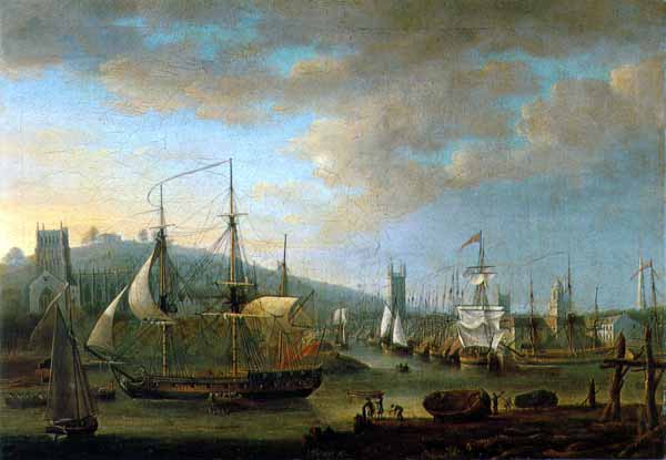
Bristol Harbour with the Cathedral and the Quay
Oil on canvas by Nicholas Pocock - 1785
This unused postcard has the printed text...
2/4059
Bristol Harbour with the Cathedral and the Quay
Oil on canvas by Nicholas Pocock, 1785
Bristol Museum & Art Gallery (K742)
Bristol City Council
J. Arthur Dixon
John Hinde Original
Nicholas Pocock (1740 - 1821) painted this picture in 1785. By then the Cathedral had already been changed several times since the first abbey had been built on the site in 1146 but the building was in relatively good repair, but still not in its final form, when this picture was painted. The houses that can just be seen to the left and right of the Cathedral were demolished in 1835 and the Cathedral was finally finished in 1897.
I think the square church tower in the centre of the picture is that of St. Stephen's at the junction of St Nicholas and Corn Streets. The church with its 150 fet tall tower was built about 1455. There was a hurricane that lasted from 26th November to 1st December 1703 that destroyed three of the pinnacles and flooded the church.
The square tower with the domed top towards the right of the image would be All Saints church in Corn Street. A church, in one form or another has stood on the site since at least 1066, but the cupola was begun in 1712 and completed in 1717. The cupola was rebuilt in 1807 by Luke Henwood, the City Surveyor.
I'm not sure what church the tall spire on the extreme right belongs to. At first I thought it was St. Mary Redcliffe but the spire of that church was destroyed by lightning in 1446 and the short turret that replaced it wasn't itself replaced by the present spire until 1870.
When this picture was painted the harbour was still tidal, the 70 acre Floating Harbour wasn't in existence until the dam and locks at Hotwells and the New Cut through Bedminster, both started in 1804 were completed, again, both in 1809 and the Feeder Canal from Temple Meads to Brislington were finished. Bristol has one of the highest tidal ranges in the world, sometimes with a 50ft difference between high and low tides in the Bristol Channel. Most ships lay on the harbour bed at low tide which put a lot of stress on them - good strong ships able to withstand this and with their cargo securely tied down to avoid shifting when the ship's keeled over were "shipshape and Bristol fashion".
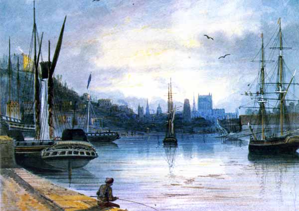
Bristol's Floating Harbour with the Cathedral, Sunrise
T. L. S. Rowbotham, 1827
This unused postcard has the printed text...
L6/SP.12519
T. L. S. Rowbotham 1783 - 1853
Bristol Harbour with the Cathedral, sunrise 1827
Oil on canvas by Nicholas Pocock, 1785
Bristol Museum & Art Gallery (M2930)
Bristol City Council
J. Arthur Dixon
Printed in Great Britain
by J. Arthur Dixon
This painting by Thomas Leeson Scarse Rowbotham (1783-1853) in 1827 shows the Floating Harbour which was completed in 1809.
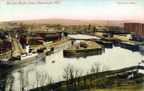
Bristol Docks from Rownham Hill
This unused postcard has the printed text...
Hayward Series
Haywards, 1 corn Street, Bristol
Printed in Great Britain
British Manufacture
This postcard image was taken from Rownham Hill and shows the main entrance to the docks. The stretch of water in the forground is the River Avon, the road along the far bank is Hotwell Road leading to Cumberland Basin Road. This is the first set of lock gates that hold the Floating Harbour. Today, the island is the pivot of the Cumberland Basin Bridge.
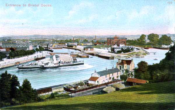
Bristol Docks from Rownham Hill
This unused postcard has the printed text...
423
Avonvale Series
J. B. & S. C.
Avonvale Series of Pictorial Post Cards
Printed in Hessan
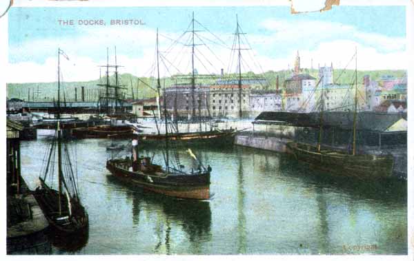
Bristol Harbour
This unused postcard has the printed text...
Copyright
G. D. & D. trademark logo
Printed in Germany
It's hard to tell where this image was taken because the background buildings do not match any scenesthat I know of. For example, the square white tower on the lft could be the Cathedral which would make the tall brown tower St. Mary Redcliffe but the shape is wrong - it looks more like Cabot Tower but that is on the opposite side of the harbour to the Cathedral.
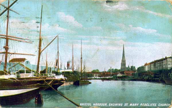
Bristol's Floating Harbour with St. Mary Redcliffe
This postcard, posted in Bristol on March 16th, 1906, has the printed text...
2461-6
Hartmann trademark logo
Using a magnifying glass I was able to make out the name of the foreground ship. This was the "Augusta", which was registered in Bristol. There were several ships with this name around the world but I think this was captained by T. Balsdon and run to Demerara in South America.
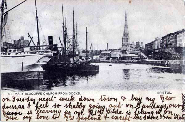
St. Mary Redcliffe from the Docks
This postcard, with an unreadable post stamp, has no other printed text.
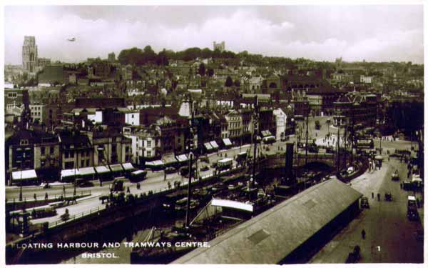
Bristol's Floating Harbour with the Tramway Centre
This postcard, posted in Bristol on March 16th, 1906, has the printed text...
Excel Series
Printed in Great Britain
This is a Real Photograph
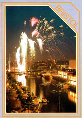
Fireworks over Bristol's Floating Harbour
This unused postcard has the printed text...
2061
Published by Pitkin Unichrome Ltd.
Tel: 01264 409200
For quite a while I've been trying to find roughly how many gallons of water the floating Harbour contains but without success, it doesn't seem to appear anywhere. Here's a rough estimate that I did...
Depending on what you read, the Floating Harbour covers an area of somewhere between 70 and 80 acres. An acre contains 43,560 square feet. Now suppose that only half of the area is actually water, the rest are docks, wharves etc. Lets say a total water area of 40 acres. That's 1,742,400 square feet of water area. The harbour has a depth of around 20ft, thats 34,848,000 cubic feet of water. Each cubic foot fo water contains 7.48 gallons of water. so, at a minimum the Floating Harbour contains 260,663,040 gallons of water.
This page created 8th September 2009, last modified 25th February 2010